GIS Classes Taught at ISU
There are many classes at ISU that teach GIS principles or that apply GIS principles to a variety of application areas. Course List
GIS Short Courses
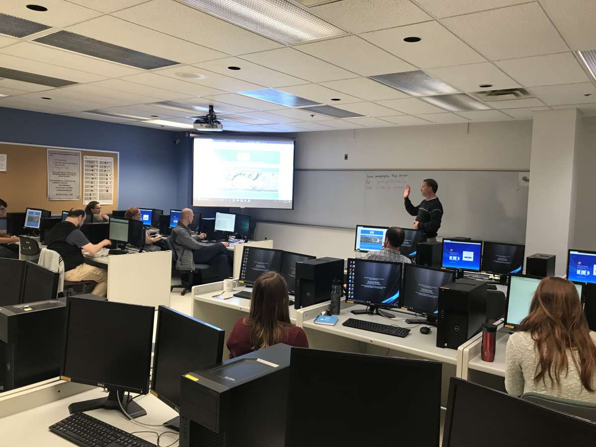
Essentials of ArcGIS Pro. This two-day course will explore the new, easy-to-use features in Esri’s ArcGIS Pro software suite. ArcGIS Pro is an all-in-one solution for the editing, visualization, query, analysis, and management of maps and spatial data. This course is intended for both new and experienced users of geographic information systems. Please contact the ISU Extension Geospatial Technology Program for dates, times, and cost.
Let's Get Started.
ESRI Virtual Campus Courses
In order to take Esri training, you will need to have an account with the ISU ArcGIS Online organization. The first steps below will register you if you don’t already have one.
- Go to https://isugisf.maps.arcgis.com.

- Click the blue button and you will log in with your ISU information. If you have not already registered with our ArcGIS Online Organization, logging in the first time will automatically register you.
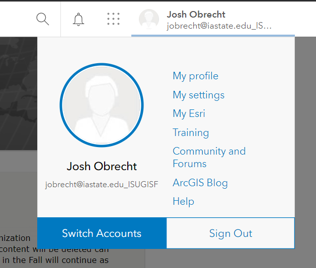
- Click your account name in the top right corner. In the dropdown, click Training. This will redirect you to the Esri Training page.
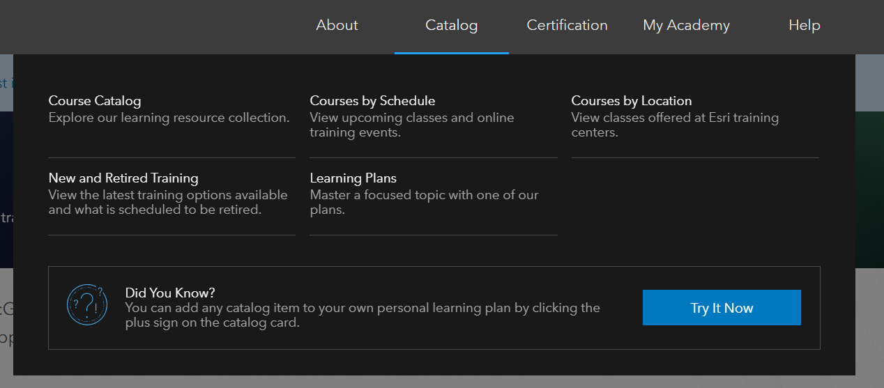
- Once on the Training page, hover over Catalog and choose Course Catalog.
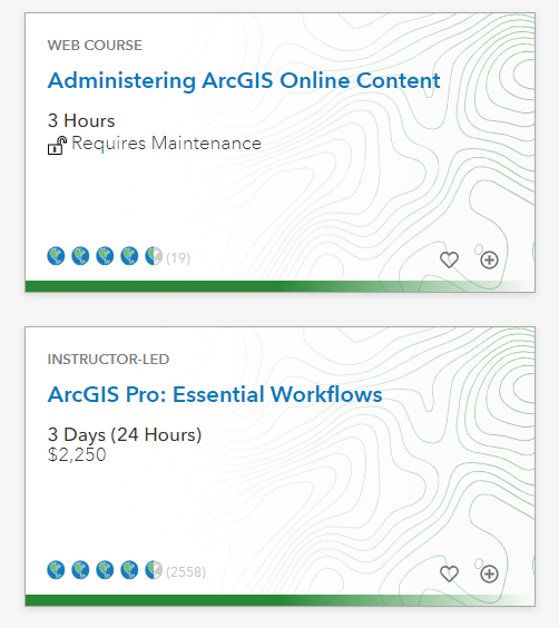
- When you click on Catalog, you will be able to see every course that Esri has available. Not all of these are free. Anything that is listed as free is obviously free but you will also see some that say Requires Maintenance. By logging in through our ArcGIS Online, you should see an unlocked lock like the first class below. This will allow you to take that course for free under our site license. If you forget to sign in, the lock would be locked and you would not be able to access that course. Some courses, mainly those that are instructor led, will show a cost. You can see this in the second class below. These you would have to pay for and there is no discount via our license.
- There are a lot of classes that you could take but in order to narrow down your choices and make the list less overwhelming, we recommend starting with a Learning Plan. These are a list of courses gathered into a group, on a given topic. After you click Catalog, you should see Learning Plans right underneath Catalog. There are many plans created by Esri and some of those will contain courses for which you need to pay. By enrolling in a Learning Plan, you do not need to take all of them, but you can take advantage of them being grouped by topic.
The GIS Facility has created the following Learning Plans to assist in your getting to know GIS, Pro and other useful topics. If you would like to enroll, just search for the name.
GIS Fundamentals – ISU
ArcGIS Pro Fundamentals – ISU
Migrate to ArcGIS Pro – ISU
ArcGIS Online Fundamentals – ISU
Advanced GIS – ISU
Scripting in GIS – ISU